Wagon Trail Campground, Rowleys Bay, Wisconsin
It’s June 18th, and I know I’m behind on the blog, but I wanted to get this current information in here for those at home who are following us. This morning, Blaine discovered that there’s been all kinds of carnage around the Lake Michigan/Lake Superior area caused by the torrential rains the past few days. Many of these are the very areas where we’re supposed to be headed this summer.
Here’s what one of our roads looks like. YIKES!
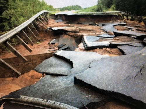
As it’s breaking up.
See the water?
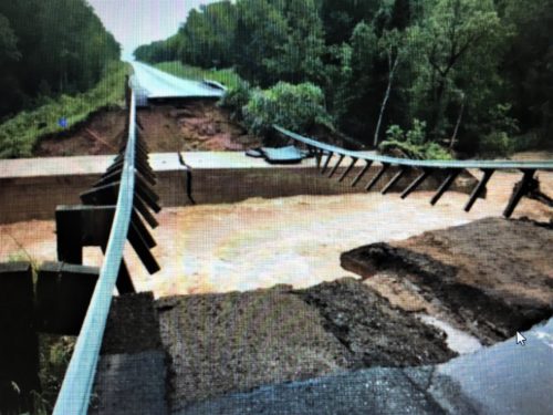
This is what’s left. . . .
still lots of water.
Now you may be saying to yourself, “Why can’t they just take another road?” If only it were that simple. Remember, we have a bus to drive around. We can’t just go on any ol’ road. We have to take truck routes. And we have an atlas that tells us that, and a setting on our gps that’s supposed to, but sometimes doesn’t, which is why Blaine doesn’t wholly rely on the gps.
Here’s what the truck routes look like in NE Ohio. The truck routes are orange.
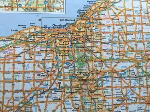
Northeast Ohio truck routes.
Easy for us to get around.
Here’s what they look like in the area we’re planning on traveling in.
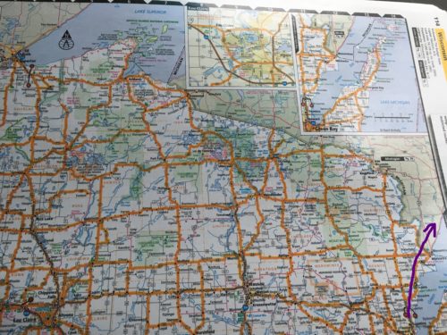
Up the east side of Wisconsin, into Michigan’s Upper Peninsula
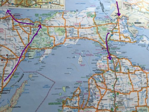
Around Lake Superior and into Minnesota, then after a tour around the Lake via Ontario, Canada, back down into the UP and into Michigan.
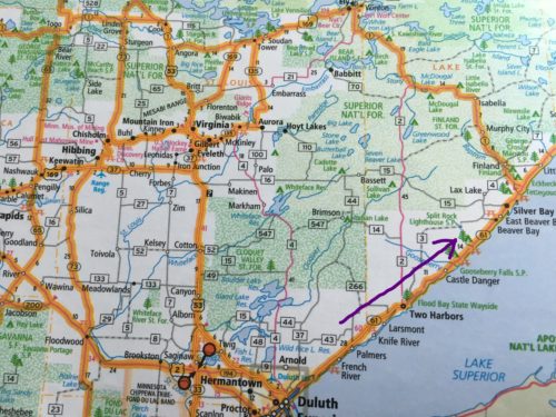
Minnesota
Not so many to choose from.
In addition, taking a circuitous route costs a lot more when you only get 8mpg.
Also, one of the washout areas is near the State Park we’re supposed to stay at in a couple of weeks.
Blaine has a lot of patience. He wants to wait a couple of days until things settle down. Me? I want to figure it out and make plans right now! Good thing he’s better at this sort of thing than I am. Yeah, he’s better all right. At a lot of things. But can he write a blog post?
