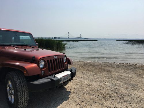
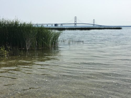
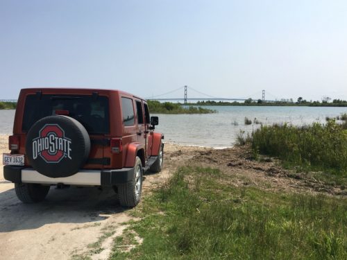
Straits State Park, St. Ignace, Michigan
Humble yourselves, therefore, under God’s mighty hand, that He may lift you up in due time. Cast all your anxiety on Him because He cares for you. I Peter 5:6-7
A few minutes after 7:00am, I hurried Blaine out the door so we could ‘train’ and see the bridge in the early morning light. Fresh morning air is always the best, don’t you think? There’s just something about it . . .
Anyway, we rode to the observation area, took a look and went home for breakfast. Those of you who know Blaine are probably pretty fascinated with how I managed to get him to delay a meal. Guess I still have my charms. 😊
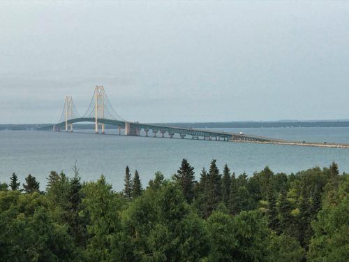
Very nice in the morning light!
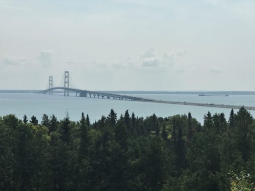
Here’s picture we took last night. Much better in the morning light!
We walked quite a ways today, but it was easy walking. I even wore my “sight-seeing sandals”. Parking at a free lot in town, we hoofed it all the way to where our ferry dock was, just to check it out ahead of time. Former Boy Scout, remember? St Ignace has a really nice, long boardwalk along the water, that we only had to leave a couple of times because presumably, whomever the property owners were at that point, didn’t want a boardwalk taking up a portion of their land.
The only bad thing was, there wasn’t anywhere to sit and have lunch where the Jeep was parked, and by the time we returned, we were both pretty hungry. So we just sat inside. Still, it was an interesting lunch view today. 😊
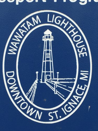
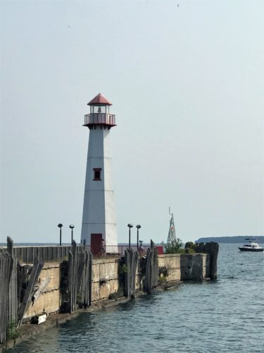
There’s a small park beside where we left the Jeep, with a lighthouse at the end of it.
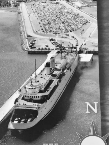
This is a picture of part of an old dock area. They used to pull trains right up here and fill the ships.
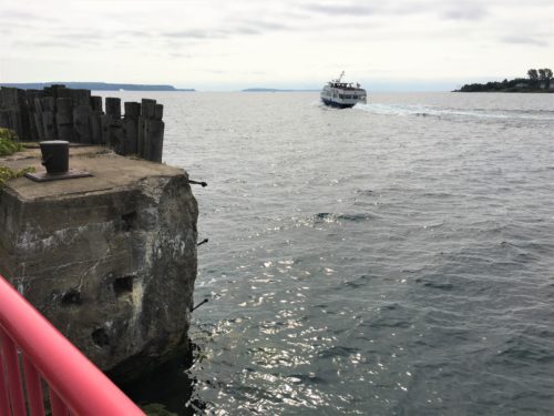
There goes a ferry on it’s way to Mackinac Island.
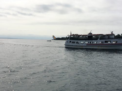
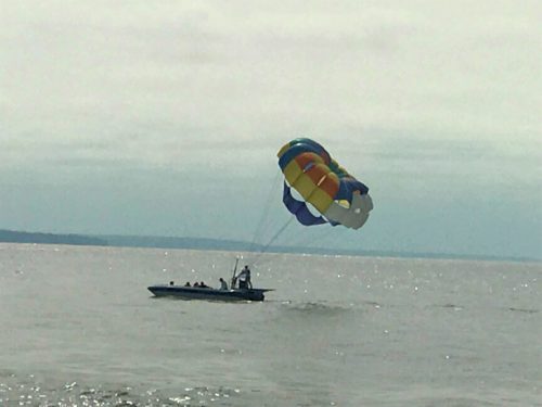
Look beyond the ferry – see the parasail going up?
There was a woman and her two retrievers hanging out at the lighthouse with us. Her husband and two sons were out there.
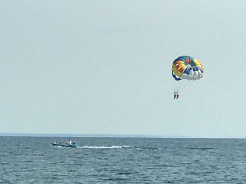
I guess it’s still ladies first.
The woman told us there were two women on the boat too, and they had the ability to send up three at a time. Guess the guys have to wait.
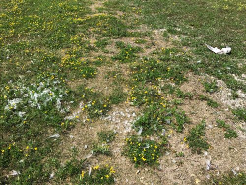
There were thousands of gnats flying around this park!! Fortunately none were around the lighthouse, or we wouldn’t have stayed!
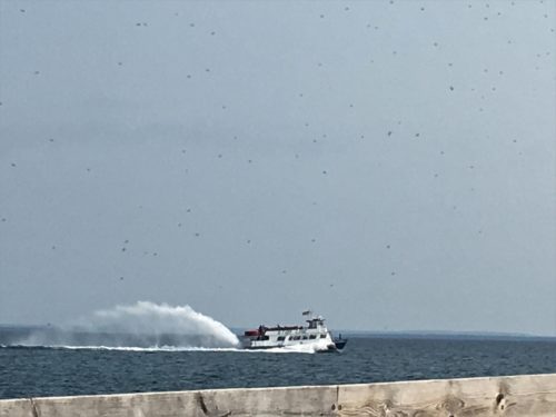
That’s the signature rooster tail one of the ferries uses. It looks cool from the land (or wherever you are), but I think the people on the back of the boat can’t see very well.
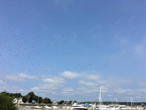
Capturing more gnats! Yuck!
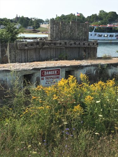
Too bad the sign’s in the way of a good picture.
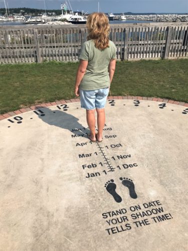
This was an interesting sundial in the park. Worked pretty well too – – once Blaine explained to me how it worked. I was trying to stand on the feet. It helps to read the directions. Or have Blaine along. : )
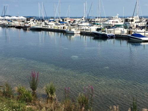
The St. Ignace marina
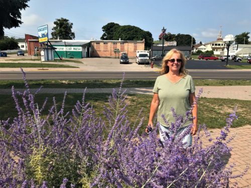
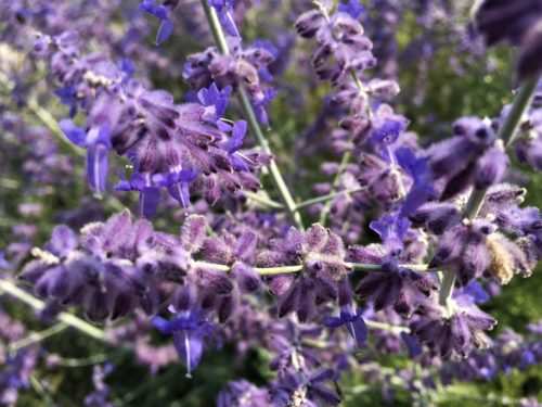
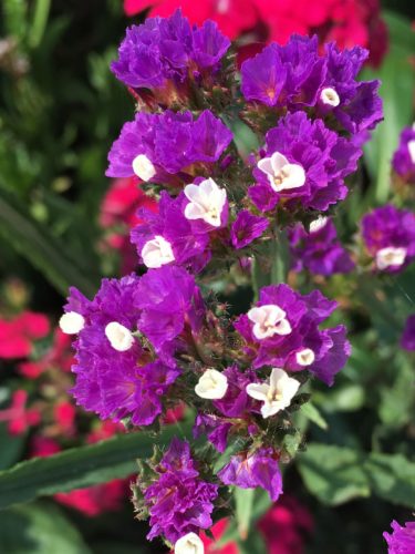
Lavender must grow well here, there was lots of it around. Pretty!
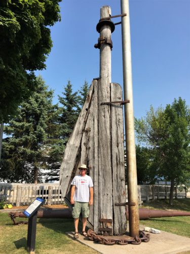
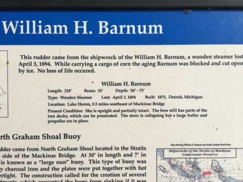
We thought this rudder looked larger than the one we saw at Whitefish Bay.
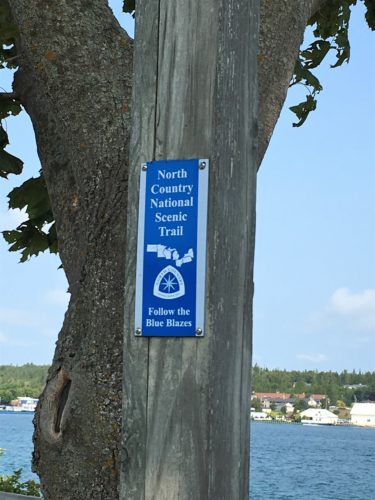
Do you happen to remember this trail? We first saw it when we were in the Pictured Rocks area near the start of our trip. Pretty cool to run into it again!
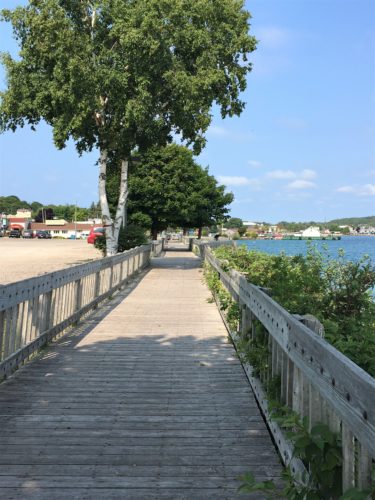
See how nice the boardwalk is?
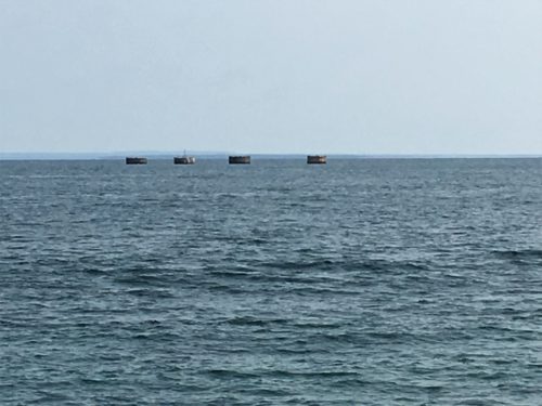
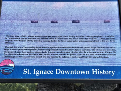
We wondered what these were, and then we ran across a sign telling us.
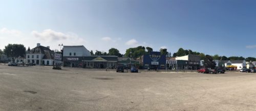
Blaine was able to take a panoramic of the other side of the street.
Once we reached our destination, we walked back via the sidewalk. It was nice too!
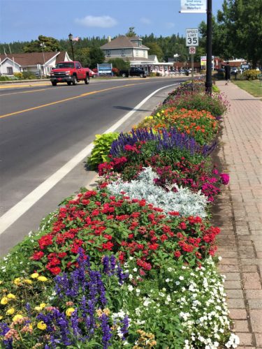
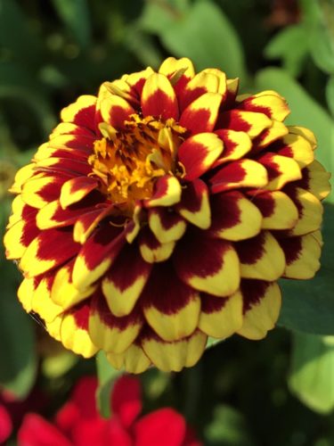
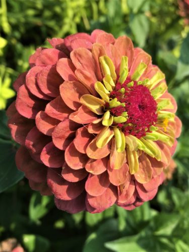
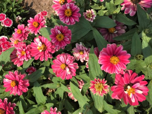
The flowers along the street are just lovely!
Our lunch view.
How much do you think it would cost to rent one of those?
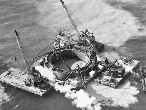
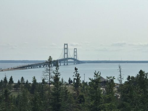
Up next on our agenda, was a drive to the official Mighty Mac (as they call the Mackinac Bridge) observation area. It afforded us a fairly close up view, lots of flowers, and some interesting information which included a video of how they built it. Unfortunately, we couldn’t hear most of it because the acoustics were so bad in the building that anytime anyone talked, or ran the hand dryer in the bathroom, you couldn’t hear the video. But it was still intriguing to watch! Great videos of the men working! For you, I have pictures and clippings from the information boards that were around the room. And a list of facts I took from the internet. I put those at the end. Oh. And even though the name ends with a ‘c’, the pronunciation is ‘naw’ with a ‘w’. Why? It’s no wonder the English language is so difficult to speak and spell!
Along the way . . .
We got the binoculars out here and we could see the end of the Grand Hotel on Mackinac Island, right in that dip on the right side.
It looks huge from here, so we can’t imagine what it will look like once we get to it tomorrow..
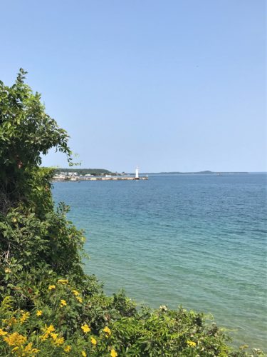
That’s the lighthouse where we just were.
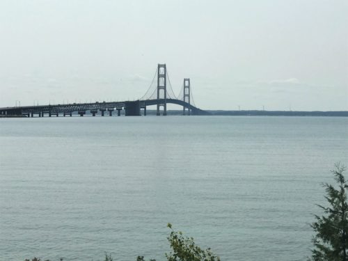
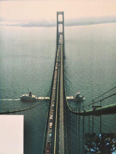
And there it is!
Proper lighting always seems to be an issue, but at least we had a good shot this morning.
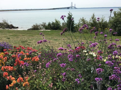
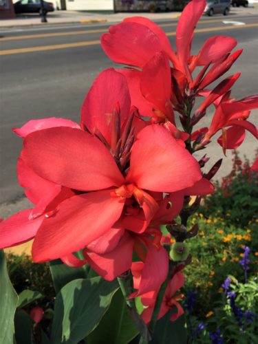
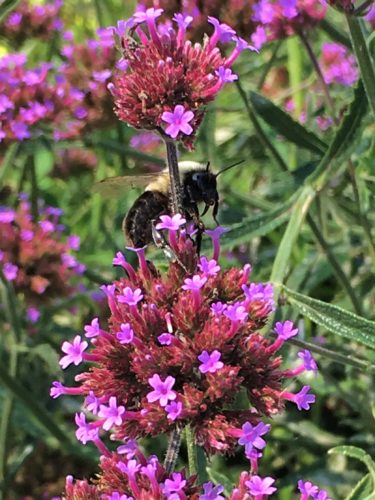
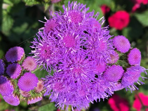
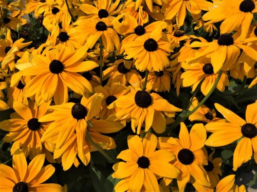
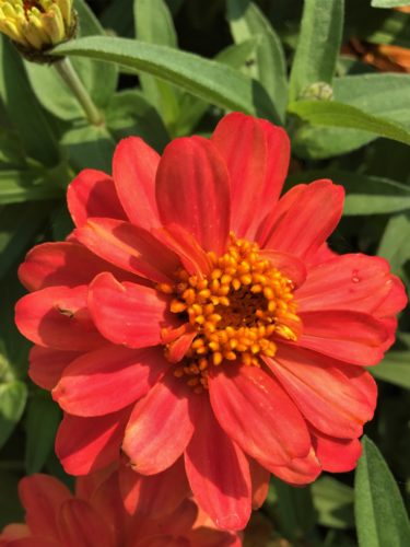
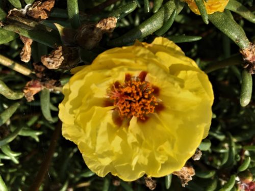
There are lots of flowers here too!
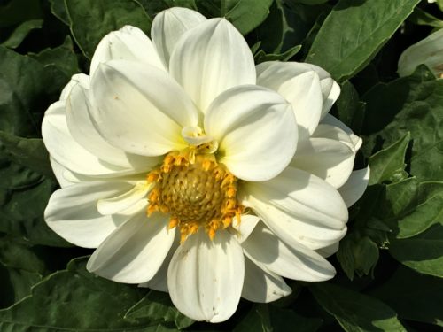
And I took lots of pictures of them! I can’t help it. They are such stunning examples of God’s love for us!

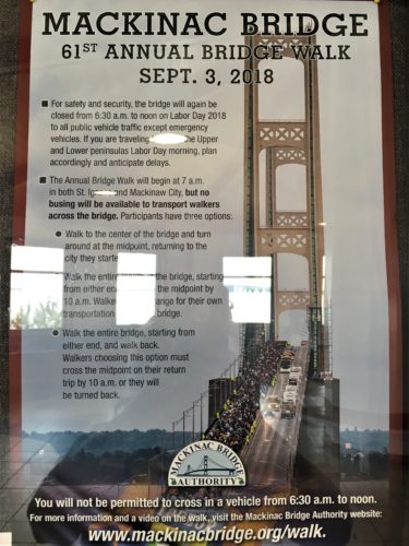
Believe it or not, they actually close the bridge for four hours one day a year so people can walk across it!
What a blast! But only if you can see past the mob of people . . . .
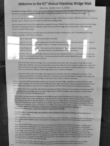
Here’s the information, just in case you’re interested in trying it.
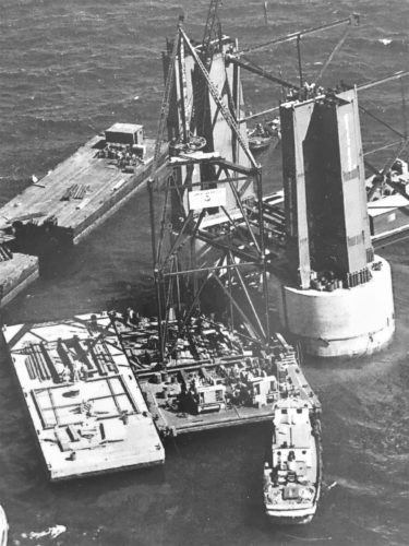
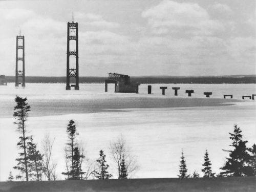
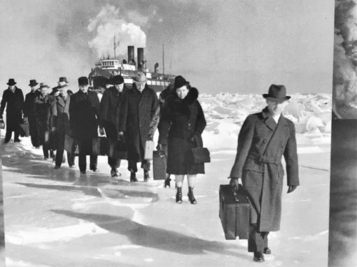
November 19, 1955
Yeah. That’s ice.
Yikes!
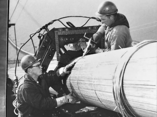
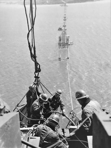
Wrapping the suspension wires.
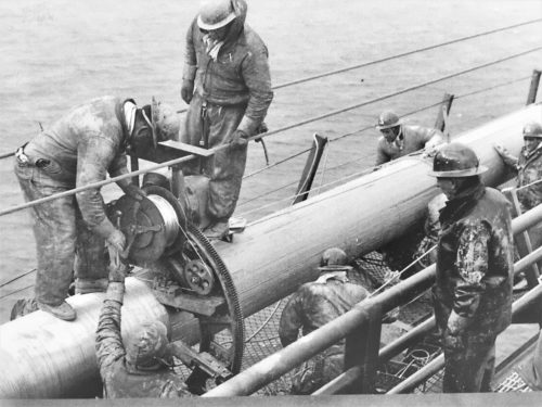
They used a machine, plus manpower.
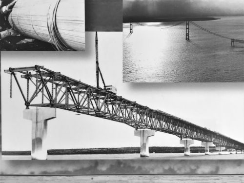
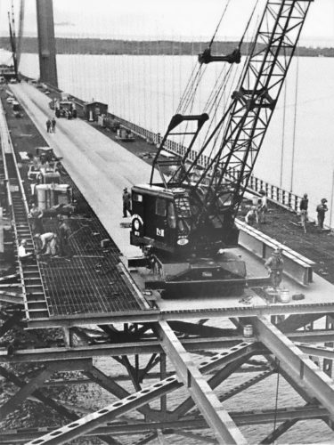
October 19, 1957
This picture was taken before the bridge was built.
That’s a ferry!
No wonder they needed a bridge!
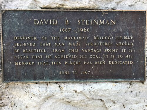
The man responsible for the design of this monstrous thing.
We could walk right up to the road.
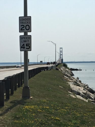
We are in the 20mph class.
It will be a nice, leisurely drive across, with opportunity for Blaine to look around and appreciate it, since we have to go so slow.
The reason? Wind.
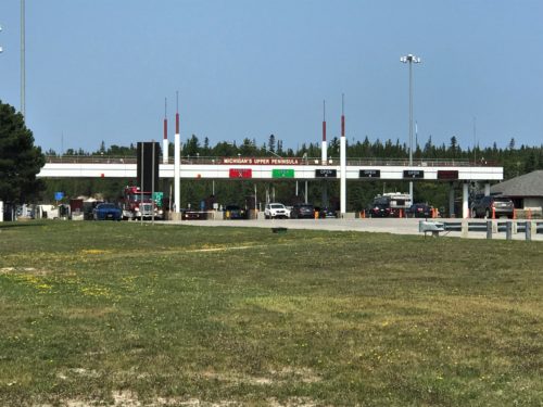
The toll both. Everyone has to pay to go across.
Murder most foul!
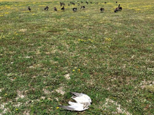
Just look at them. Wandering around like nothing happened. I just know it was one – or all of you!
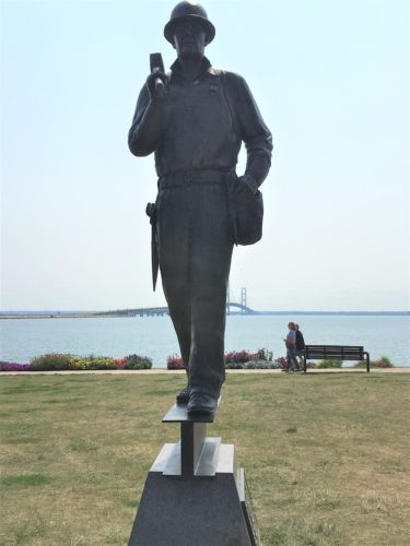
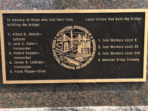
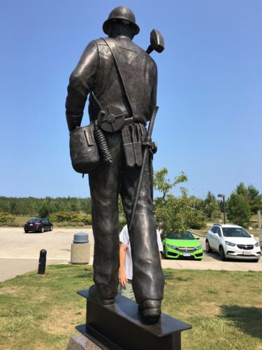
A memorial to those who lost their lives.
We thought it incredible that there were only five, considering what they did – – and where they were!
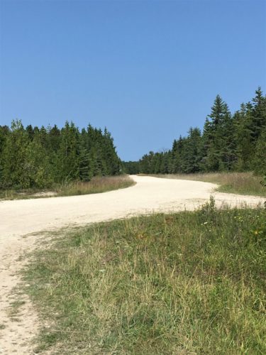
Then we went for a scenic drive on a dirt road, which was nice.
Stopping place #1
Stopping place #2
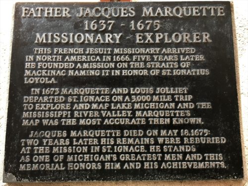
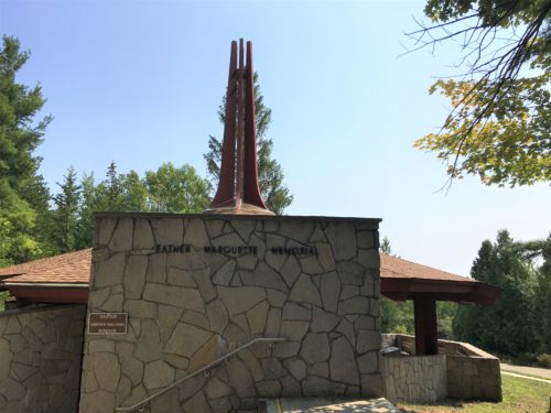
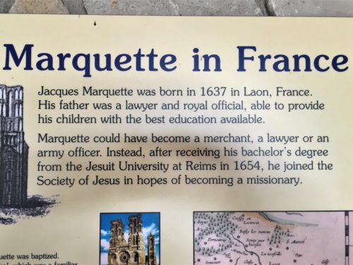
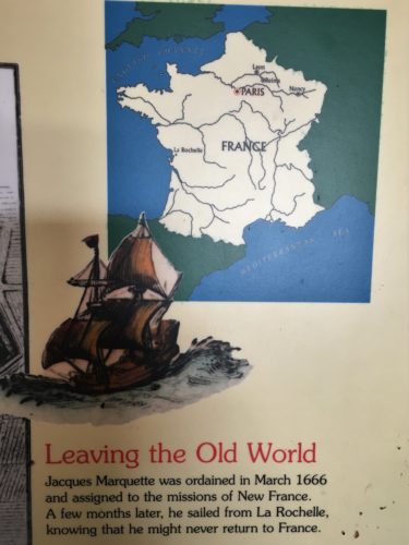
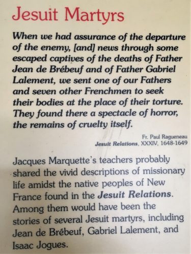
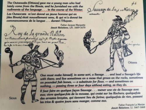
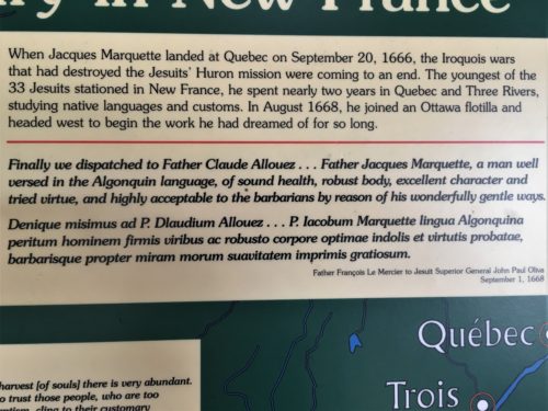
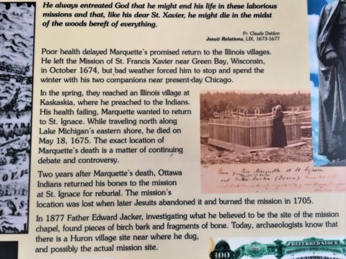
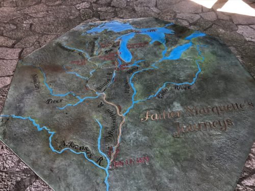
And lastly, a search for the Father Marquette Memorial. This missionary really made his mark in the UP – even though it was 350 years ago. Just goes to show you – – God uses all things, all people, and in all times and places to make Himself known.
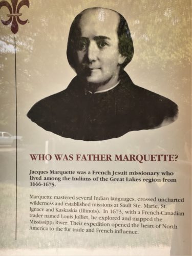
How’d they get a picture of him? He died in 1675. Hmmm…..
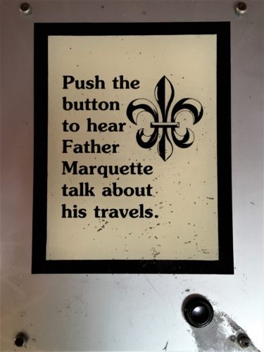
And a recording of his voice, too!
He spoke English with a French accent. : )
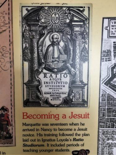
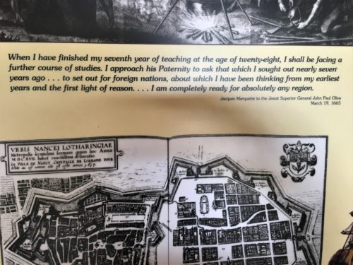
I took pictures of a few snippets from the enormous amount of information on the story boards.
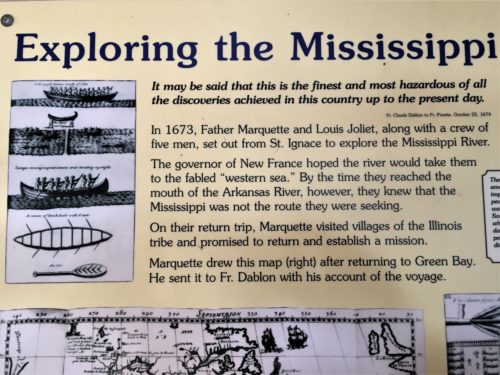
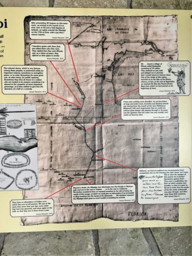
This map was great – one of his originals.
If you zoom in, you can read the info on it.
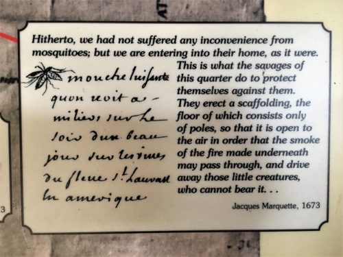
Here’s a blow-up of the bottom right one. We really connected with this one! We’ve had lots of inconvenience from them this summer. Wish we’d known this trick!
This map was on the floor.
Hard to tell but it was good too.
There was a limestone path at the memorial, so we walked that and stopped to take one last look at the bridge from the scenic overlook, and back home we went.
We’d heard the town did fireworks every Saturday in the summer, and even considered driving back over, but they don’t start until 10pm, and even though we’re retired, our bedtime’s still ten. However, we never imagined it would be such a long show! It lasted 15 minutes! Had we known, we most likely would have gone back to town. We did go outside, and were able to see about half of the show between the trees. It was close enough we could hear all the booms, which is really what makes fireworks. I’ve seen them without the sound, and it’s just not the same. Pretty. But no excitement.
Below are the facts I promised you from the Mackinac Bridge Authority website:
The Mackinac Bridge is currently the fifth longest suspension bridge in the world. The bridge opened to traffic on November 1, 1957. The following facts and figures are quoted from David Steinman’s book “Miracle Bridge at Mackinac”.
LENGTHS
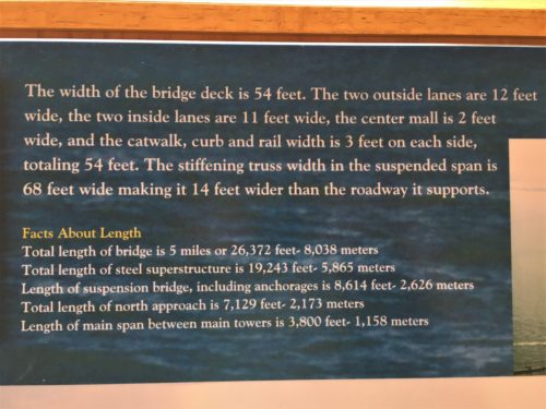
| Total Length of Bridge (5 Miles) | 26,372 Ft | 8,038 Meters |
| Total Length of Steel Superstructure | 19,243 Ft. | 5,865 Meters |
| Length of Suspension Bridge (including Anchorages) | 8,614 Ft. | 8,614 Ft. |
| Total Length of North Approach | 7,129 Ft. | 2,173 Meters |
| Length of Main Span (between Main Towers) | 3,800 Ft. | 1,158 Meters |
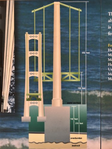
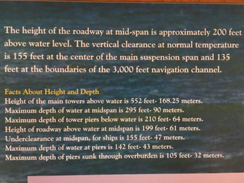
HEIGHTS AND DEPTHS
| Height of Main Towers above Water | 552 Ft | 168.25 Meters |
| Maximum Depth to Rock at Midspan | Unknown | Unknown |
| Maximum Depth of Water at Midspan | 295 Ft. | 90 Meters |
| Maximum Depth of Tower Piers below Water | 210 Ft. | 64 Meters |
| Height of Roadway above Water at Midspan | 199 Ft. | 61 Meters |
| Underclearance at Midspan for Ships | 155 Ft. | 47 Meters |
| Maximum Depth of Water at Piers | 142 Ft. | 43 Meters |
| Maximum Depth of Piers Sunk through Overburden | 105 Ft. | 32 Meters |
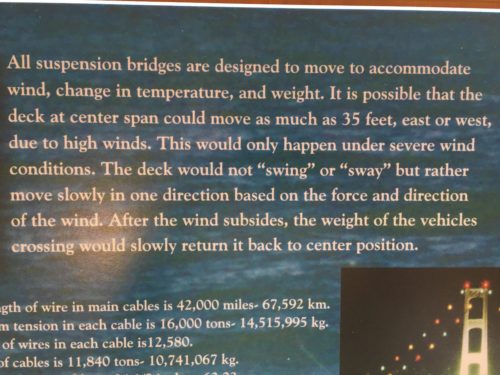
CABLES
| Total Length of Wire in Main Cables | 42,000 Miles | 67,592 km |
| Maximum Tension in Each Cable | 16,000 Tons | 14,515,995 kg |
| Number of Wires in Each Cable | 12,580 | |
| Weight of Cables | 11,840 Tons | 10,741,067 kg |
| Diameter of Main Cables | 24 1/2 Inches | 62.23 cm |
| Diameter of Each Wire | 0.196 Inches | .498 cm |
WEIGHTS
| Total Weight of Bridge | 1,024,500 Tons | 929,410,766 kg |
| Total Weight of Concrete | 931,000 Tons | 844,589 kg |
| Total Weight of Substructure | 919,100 Tons | 326,931,237 kg |
| Total Weight of Two Anchorages | 360,380 Tons | 326,931,237 kg |
| Total Weight of Two Main Piers | 318,000 Tons | 288,484,747 kg |
| Total Weight of Superstructure | 104,400 Tons | 94,710,087 kg |
| Total Weight of Structural Steel | 71,300 Tons | 64,682,272 kg |
| Weight of Steel in Each Main Tower | 6,500 Tons | 5,896,701 kg |
| Total Weight of Cable Wire | 11,840 Tons | 10,741,067 kg |
| Total Weight of Concrete Roadway | 6,660 Tons | 6,041,850 kg |
| Total Weight of Reinforcing Steel | 3,700 Tons | 3,356,584 kg |
RIVETS AND BOLTS
| Total Number of Steel Rivets | 4,851,700 |
| Total Number of Steel Bolts | 1,016,600 |
DESIGN AND DETAIL DRAWINGS
| Total Number of Engineering Drawings | 4,000 |
| Total Number of Blueprints | 85,000 |
MEN EMPLOYED
| Total, at the Bridge Site | 3,500 |
| At Quarries, Shops, Mills, etc. | 7,500 |
| Total Number of Engineers | 350 |
IMPORTANT DATES
| Mackinac Bridge Authority Appointed | June, 1950 |
| Board of Three Engineers Retained | June, 1950 |
| Report of Board of Engineers | January, 1951 |
| Financing and Construction Authorized by Legislature | April 30, 1952 |
| D.B. Steinman Selected as Engineer | January, 1953 |
| Preliminary Plans and Estimates Completed | March, 1953 |
| Construction Contracts Negotiated | March, 1953 |
| Bids Received for Sale of Bonds | December 17, 1953 |
| Began Construction | May 7, 1954 |
| Open to traffic | November 1, 1957 |
| Formal dedication | June 25-28, 1958 |
| 50 millionth crossing | September 25, 1984 |
| 40th Anniversary Celebration | November 1, 1997 |
| 100 millionth crossing | June 25, 1998 |